Carleton University - School of Computer Science Honours Project
Summer 2021
Automating Remote Sensing Data Analysis with Deep Learning and Feature Engineering

ABSTRACT
At the beginning of the decade, accessibility to geospatial data was limited; low-resolution aerial and satellite imagery was both costly and cumbersome to use. This is no longer a problem in the 21st century. With the advent of technology in remote sensing, the new challenge is to make sense of the increasingly hefty amounts of data collected. A single aerial survey can produce hundreds of gigabytes of orthomosaic* Tagged Image File Format (TIFF) data. Pre-processing, preparing, and annotating the big data presents a huge challenge that academics and researchers alike must overcome.
As part of the mission of the Northern Tornadoes Project (NTP), “to better detect tornado occurrence throughout Canada, improve severe and extreme weather understanding and prediction, mitigate against harm to people and property, and investigate future implications due to climate change”, the NTP team seeks to detect and investigate all Canadian tornadoes. Considering close to two thirds of Canada’s terrain is defined by the boreal forests, analyzing these seldom-studied remote events can provide invaluable insights in extreme wind research.
Following confirmation of tornadic activity in rural forested areas, an orthomosaic of a pre-annotated region using Planet (2021 Planet Labs Inc https://www.planet.com/) is selected for an aerial survey. Using high-density LiDAR and Near-Infrared (NIR) Imagery, orthomosaics are captured at ~5cm/pixel resolution sometime over the next few weeks. Understanding the count, density, and ratio of fallen to upright trees in the images can help determine the Enhanced Fujita* scale rankings of the tornado.
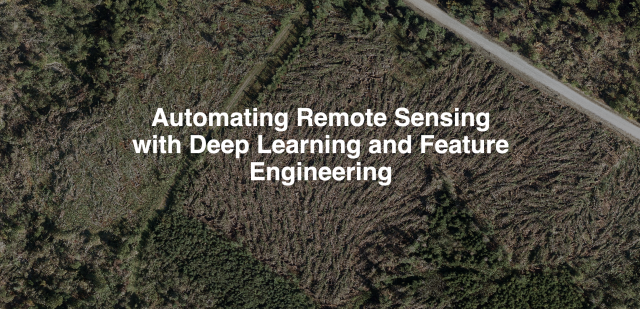
This project aims to create a remote sensing data analysis tool (or set of tools) that not only serve to detect upright trees, but also vectorize, annotate and Hough transform through a six step feature engineering process, the treefall patterns.
----
Western University Communications and Public Affairs. (n.d.). The Northern Tornadoes Project. Northern Tornadoes Project. https://www.uwo.ca/ntp/.
* An orthomosaic is a type of image product that has been photogrammetrically orthorectified through color balancing and geometric correction to produce a stitched mosaic dataset.
* The Enhanced Fujita scale is a measure that categorizes the intensity of tornadoes in the United States and Canada based on the estimated wind speeds from damage indicators and degrees of damage. There are six categories of damage ratings, ranging from EF0 and EF1 to EF5 corresponding to wind speeds of 100km/h to 500km/h respectively.